This article is more than 1 year old
Revealed: How Street View marks its territory
Google cocks its leg on South London fence
Those of you who might have wondered just how Google maintains its global supremacy in privacy-busting black ops, and prevents usurpers deploying snoopmobile fleets of their own to photograph the entire planet for exposure to the unwashed masses, might be surprised to learn that the method owes little to hi-tech and more to traditional canine techniques to warn off rivals:
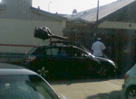
This revealing snap was captured by the chaps at battery manufacturer PAG Ltd, down in Raynes Park, at exactly 14:13 on 26/09/08. Our informant explains that the Orwellian black Opel "came down our back road once with the camera up, then a few minutes later returned with the camera down". He adds: "The driver then jumped out and urinated up the fence."
Well, we assume that once the opposition get a whiff of the potent musk of Google's unlimited ambitions and financial resources, they run yelping from the scene like whipped dogs. That scene, btw, is exactly here on Google Earth (.kmz) and here on Google Maps:
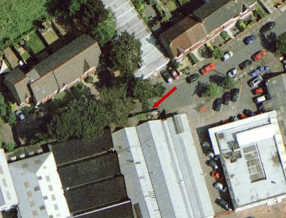
Yup, we reckon that's accurate to within 30cm of the shameless territory marking - a precision made possible by Google's own satellite imagery. But how, we hear you cry, does the search monolith ensure its spycar operatives achieve a similar level of cartographical accuracy? The answer may surprise you...
