Original URL: https://www.theregister.com/2013/08/01/chav_picam/
LOHAN serves up Raspberry Pi sensorgasmotry
Inside our spaceplane mission's fruity electronics
Posted in Science, 1st August 2013 11:03 GMT
The Low Orbit Helium Assisted Navigator (LOHAN) team is battling away on several fronts ahead of next month's launch of the Vulture 2 spaceplane, and while there's still plenty of work to do, we do at least have the mission electronics fit for duty.
![]() Our recent test flight of the Special Project Electronic Altitude Release System (SPEARS) control board proved successful, demonstrating that we can indeed get a rocket motor igniter to go pop at a predetermined altitude.
Our recent test flight of the Special Project Electronic Altitude Release System (SPEARS) control board proved successful, demonstrating that we can indeed get a rocket motor igniter to go pop at a predetermined altitude.
While SPEARS was quietly going about its business, it was the Raspberry Pi tracker/camera rig aboard our Covert High Altitude Vehicle (CHAV) aircraft which delivered the most entertainment.
This "PiCam" set-up is the work of hydrogen head honcho Dave Akerman, and is an evolution of his tried-and-trusted Pi tracker which had already delivered live Slow Scan Digital Video (SSDV) images from aloft via a webcam.
Naturally, as soon the diminutive PiCam became available, Dave had that off to the stratosphere, with similarly impressive results.
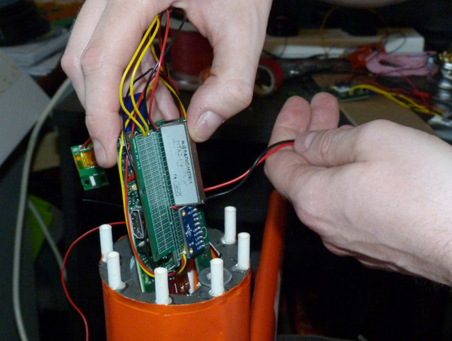
Here's the Pi before insertion into the CHAV's fuselage. The PiCam is in the nose, and you can just see the ribbon cable for that coming out of the back of the aircraft's nose podule:

Dave explained: "As usual it has a Radiometrix NTX2 radio transmitter and UBlox GPS receiver, (both from fellow LOHAN team member Anthony Stirks's HAB Supplies), and the camera, all connected to a model A Pi.
"An addition for this flight was a 9-axis IMU (Interial Measurement Unit), which the Pi used to measure and log accelerometer, gyro and compass data as well as temperatures and pressure."
In the event, the tracker proved a tight fit, due largely to the batteries (Energizer Ultimate Lithiums - the high-altitude power source of choice).
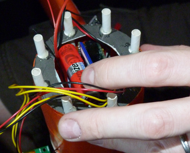
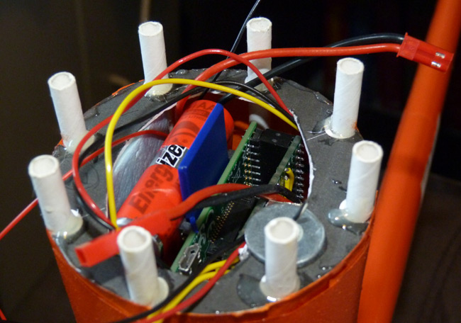
Dave said: "We used six AA cells through a switched-mode regulator. The cells were chosen less for their capacity and more for the weight they would bring to the nose of the aircraft. For the flight time we had, just four AAAs would have been enough, but wouldn't have brought the centre-of-gravity far enough forward for flight."
The only physical modification from Dave's previous flights was to use an extended 300mm CSI ("Camera Serial Interface, disappointingly," Dave noted) cable. This was to allow connection of the PiCam to the board before fitting the CHAV node podule to the fuselage.
Regarding software, Dave said: "It was pretty much as on previous flights, except for the logging of all that extra data. The other change was for it to switch the camera to video mode when descending through 2,000 metres, to capture the landing, before switching back to images again. Also, the software was set to send small images at low altitudes and larger images at higher altitudes (above 3,000 metres)."
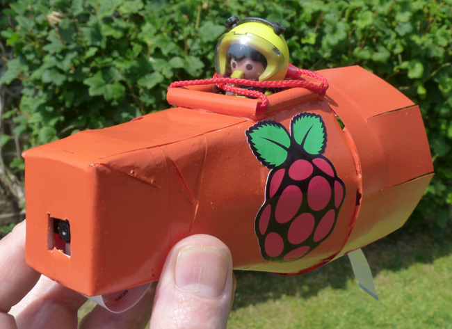
With the tracker installed, we grabbed a couple of fetching snaps of our plucky Playmonaut and the CHAV's Pi nose artwork:

And the results from the PiCam? We'll get to that in a bit, but first we should raise a well-deserved pint to Anthony Stirk and his miniature PAVA trackers.
Taking snaps 19 miles above Earth
We had two of these lightweight gadgets for the mission - one in the CHAV and another in the main payload box - both acting as back-up trackers.
![]()
Anthony brewed up the PAVA with a view to making a tracker "small enough and power efficient enough to be run from a single battery for enough time for a flight and possibly to reside in the neck of a balloon".
Cue an ATMega328P Microcontroller, Ublox MAX6 GPS and a HopeRF RFM22B radio module and you've got a tracker small enough to insert into the CHAV's fuselage through a small aperture:
![]()
Both units performed impeccably during the flight, as did the PiCam:


Dave said of the mission: "For me the impressive thing was the camera and Pi kept working with outside temperatures down to -60°C with minimal insulation."
Indeed, and at the end of this vid of some of the flight footage, you can see the PiCam video grab from 2,000m to the tree near Perham Down on the edge of Salisbury Plain, where the flight ended:
All in all, then, a great success for the LOHAN electronics chaps. As a final bonus, Dave provided this "sensorgasmotry" from the Pi, representing around three minutes either side of the landing:

Dave explained: "The green line is the air pressure. This increases from 820mb at an altitude of around 1,800m to 1007mb at landing and is then constant.
"The purple jagged line going through it is the temperature, gently rising from 8°C to 21°C, and still getting warmer in the tree (which provided shelter from the wind).
"The three lower lines are accelerometer readings from the 3-axis magnetometer. The fact that the yellow line flips from negative to positive shows that the plane ended up inverted after the collision with the tree"
In case you're wondering, the negative to positive flip was because the Pi was mounted upside down in the CHAV, so the sensor correctly read this initial inversion.
The minimum recorded temperature was -47°C, although "it would have been colder, but sunlight heats the sensor", as Dave put it. The minimum pressure recorded was 5mb, though this is beyond the specification for the IMU. ®
Further LOHAN resources:
- New to LOHAN? Try this mission summary for enlightenment.
- You can find full LOHAN coverage right here.
- Join the expert LOHAN debate down at Reg forums.
- All the LOHAN and Paper Aircraft Released Into Space (PARIS) vids live on YouTube.
- For our SPB photo archive, proceed directly to Flickr.
- We sometimes indulge in light consensual tweeting, as you can see here.
LOHAN - A Special Projects Bureau production in association with...


