This article is more than 1 year old
Chinese black helicopters circle Google Earth
Mystery military project wows the crowd
Don't, however, spend the next three days scouring the world's mountain ranges trying to find a geographical match: the legwork has already been done for you by this enterprising Google Earth Community member who correctly identified the model as representing this disputed area on the Chinese/Indian border.
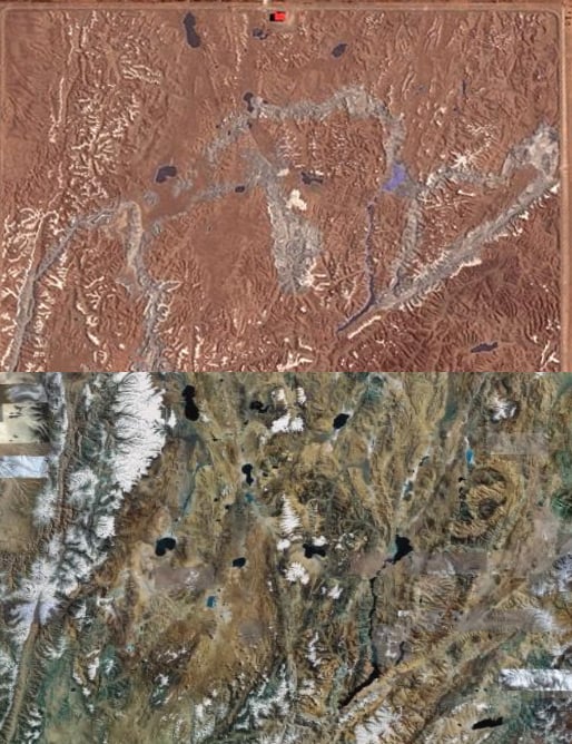
Here's a comparison of the Chinese model and the Google Earth image of the region in question...
...while a closer look reveals the meticulous attention to detail:
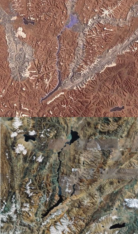
It's clear that a huge amount of time and resources has been invested in this perplexing scale model, which incidentally represents an area of around 450 by 350 kilometers. The big question is: why?
The only sensible explanation we can come up with is that it's a training aid for pilots - possibly helicopter jockeys - designed to familiarise them with the landscape should military action ever be required.
No doubt you lot can come up with some better suggestions, but while you ponder this mystery keep one eye open for the black helicopters of Huangyangtan. ®
Bootnote
Thanks to Ken Welch for the tip-off.
